Let the fun continue for at least one more year.
Bill
Let the fun continue for at least one more year.
Bill
Today I had the pleasure of taking my daughter Jen on a whirlwind tour of Refuge. She is from Washington State and was in Maryland with her husband and two of our grandchildren to visit my wife and me for the holidays. We drove the entire Wildlife Loop, including the part by the firing ranges where the general public normally does not see. Some of the highlights included driving by Tipton Airfield, seeing Lake Allen, looking at the Prickly Pear (Opuntia humifusa) near the Lake, and driving through some of the western part of the North Tract. It was fun showing her the refuge and I think it was fun for her connecting the locations she had heard about with actually seeing them. It was a good chance to spend some quality father-daughter time.

Today, 27 December 2011, I went out to the end of Millrace Road to Emmy’s Pond. Took some pictures along the way.


Emmy’s Pond is located at the end of Millrace Pond and is named after Emmy Holdridge, a volunteer on the refuge who brought it to the attention of people on the refuge.
Millrace Road is follows a major part of the southern boundary of the North Tract. To access it, you must turn right off of Duvall Bridge Road just before you get to Duvall Bridge. The road is roughly two miles long. For the first part of the road, you can see the Millrace itself. It is a channel which was dug many years ago, and still has running water fed mostly from Thomas Branch. Just past Millrace, you can see Millrace Swamp on your right. (NOTE: Millrace Swamp is the body of water pictured in this blog’s banner above.)
Continuing past Millrace Swamp the road passes over Old Thomas Branch and Cinnamon Fern Branch before arriving at Emmy’s Pond.
The road is impassable to vehicles at Emmy’s Pond due to fallen trees and roadbed erosion. It is possible to hike the road to the end at Patuxent River. Along much of Millrace at the far end there is a bluff to the north that will be worth exploring this next season.
I found some Indian Pipe (Monotropa uniflora) at one station on the bluff last year.

I spent a few days on vacation over Thanksgiving in Washington State and took a few pictures of nature while there.

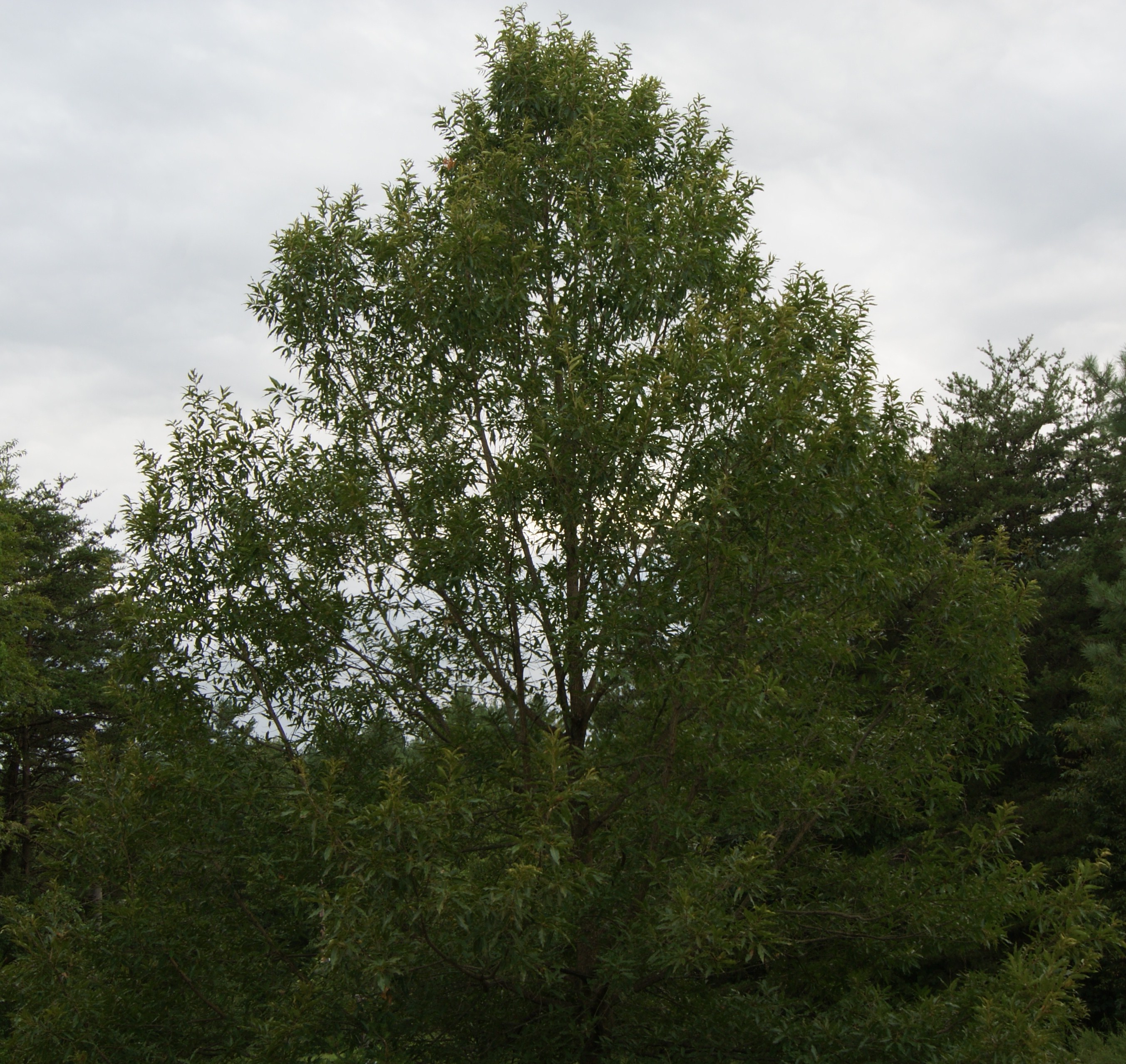
While driving up to my parent’s place on Pleasant Prairie, I stopped by Plantes Ferry Park and took some pictures of Ponderosa Pine (Pinus ponderosa Douglas ex C. Lawson. subsp. ponderosa ) along the Spokane River. It was first described by Stephen Douglass in 1826. The exact type location (the place where a species of plant was first collected) of this pine species is described as along the Spokane River near present-day Spokane. Although precise location is not known, I decided to take some pictures in a location as described as its type location.

The Ponderosa Pine has at least a couple of superlatives attached to it. It is perhaps the most widespread species of pine in North America and at 286 feet, one specimen holds the record for the tallest pine of any species. It is also the state tree of Montana.

The most common subspecies (the one pictured here) features three long stout needles per cluster. Its orange colored bark is rather distinctive. It can form deep crevices and the outer bark is made up of flake which resemble jigsaw pieces that are stacked.

It is the most common tree around Spokane and can be seen almost everywhere.


Today, I went out to Blue Heron Pond and saw something I had never seen before – bluegill spawning beds. Male bluegills build these beds by scooping out the sand and gravel from the bottom of the ponds or lakes. After they are done, they start the business of attracting a female. He does this by circling around the bed and making grunting noises. Once a female is attracted to the male, the two of them conduct an intricate spawning dance.
After a while, she lays her eggs and then he fertilizes them. He then chases the female out and guards the eggs.

When I first saw these, I had no idea what I was looking at. Upon closer examination, I saw fish circling around in the middle of them, so I figured it must have been something to do with spawning….
The fun part about observing nature is that you can learn something fascinating at anytime.
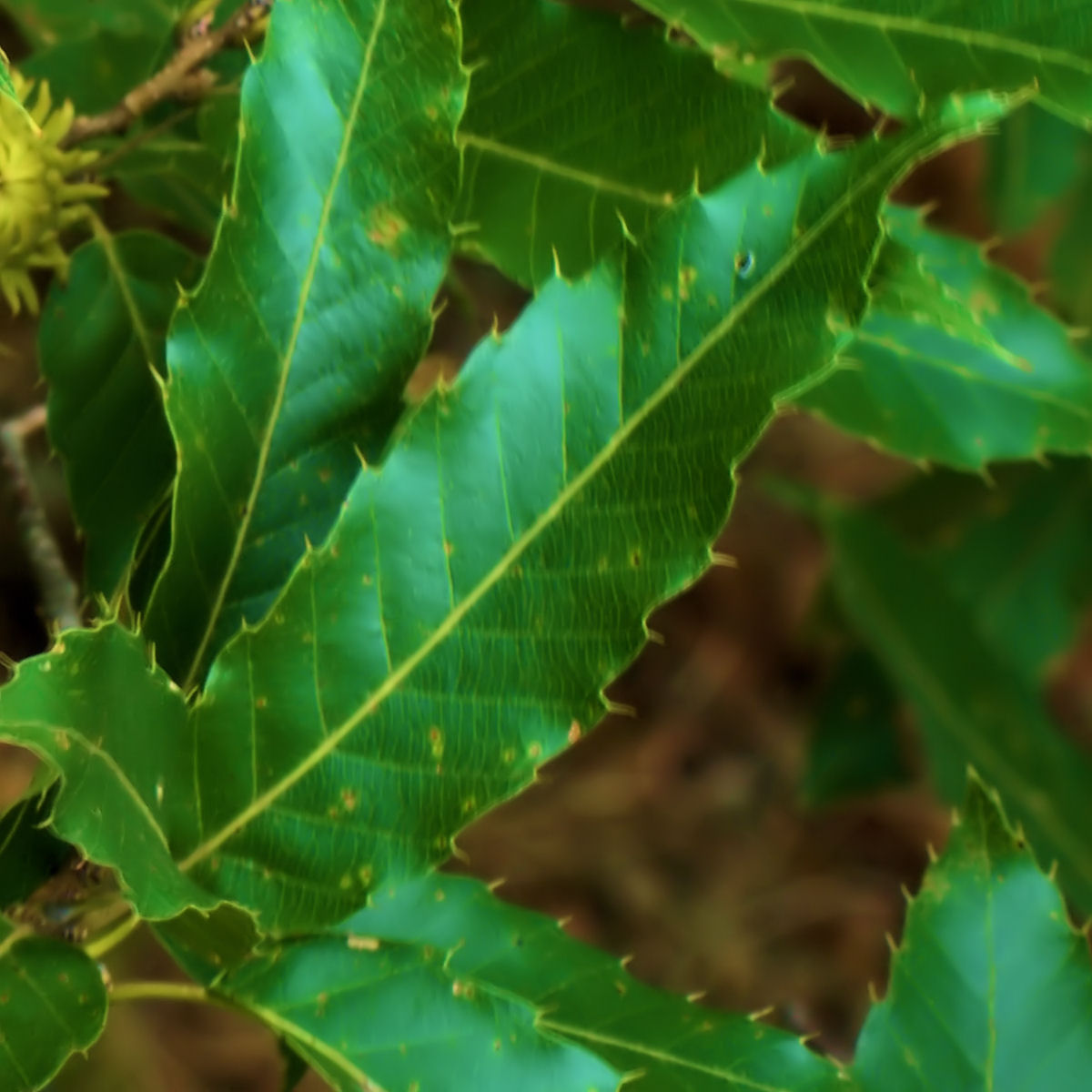 The Sawtooth Oak (Quercus acutissima Carruthers) is not native to North America, but rather it is native to Asia. It is sometimes found planted as an ornamental tree in North America. Two of its distinguishing features are its bur covered acorns and the saw-toothed leaves. Although little is known about its ecology and ability to establish and spread, some people consider it to be an invasive species. In North America, there are two native types of oaks, red oaks (Section Lobatae) and white oaks (Section Quercus). The Sawtooth Oak is neither one. Instead it belongs to the Section Cerris, a section of the genus characterized by shoot buds surrounded by soft bristles, bristle-tipped leaf lobes, and acorns that mature in about 18 months.
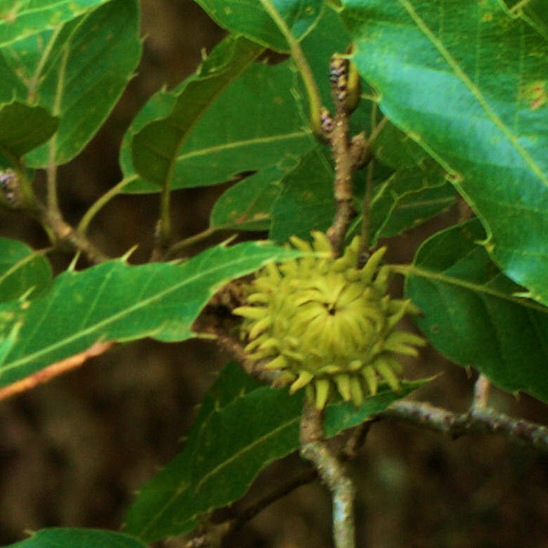
The Sawtooth Oak was planted on the Refuge on North Tract north of Lake Allen on the south edge of the powerline right-of-way. The trees are healthy and persisting. There is no evidence that they are actively spreading, perhaps because the animals are getting to the acorns before they are able to germinate.
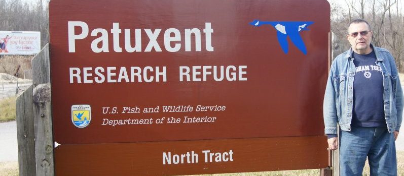
I had a meeting on 14 September 2010 with the deputy director of the Patuxent Research Refuge (the center where they did research on the Whooping Crane) and one of the biologists at the Refuge. It looks like they are going to support my proposal to survey the plants on the North Tract of the Refuge and issue a special use permit. That way I will have access to parts of the refuge that the general public doesn’t. This is going to be fun and will take up a lot of time. But it will be worth it. Biologists have surveyed the other tracts in the refuge in the past but the North Tract has never been surveyed. In addition to regular plant collection, I will be adding the dimension of taking pictures. The Purple False Foxglove is one of the plants I found in the refuge.
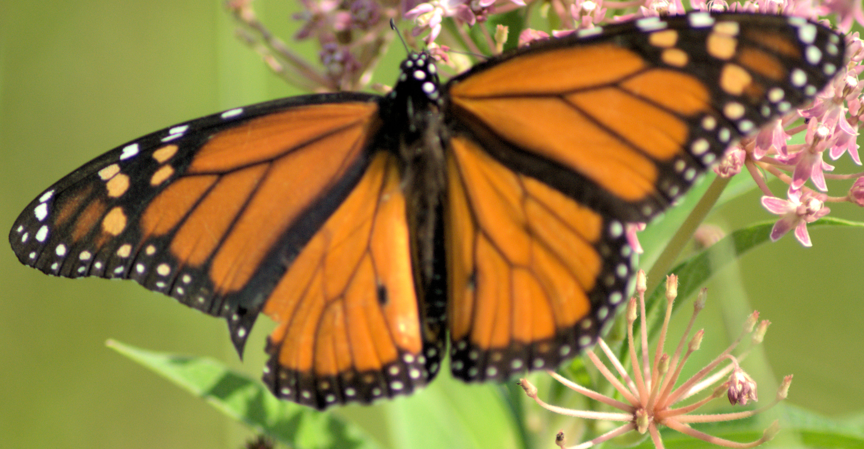
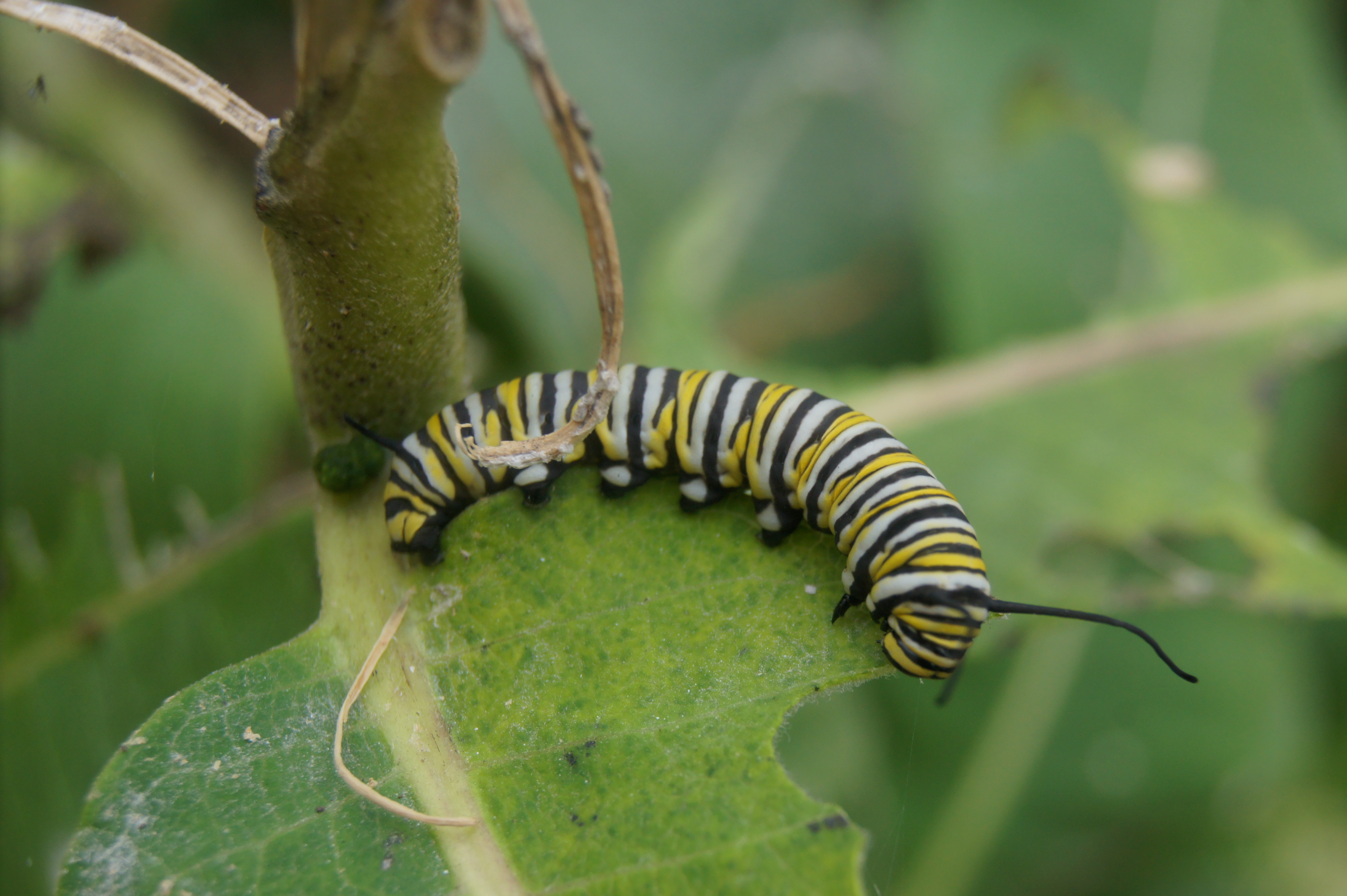
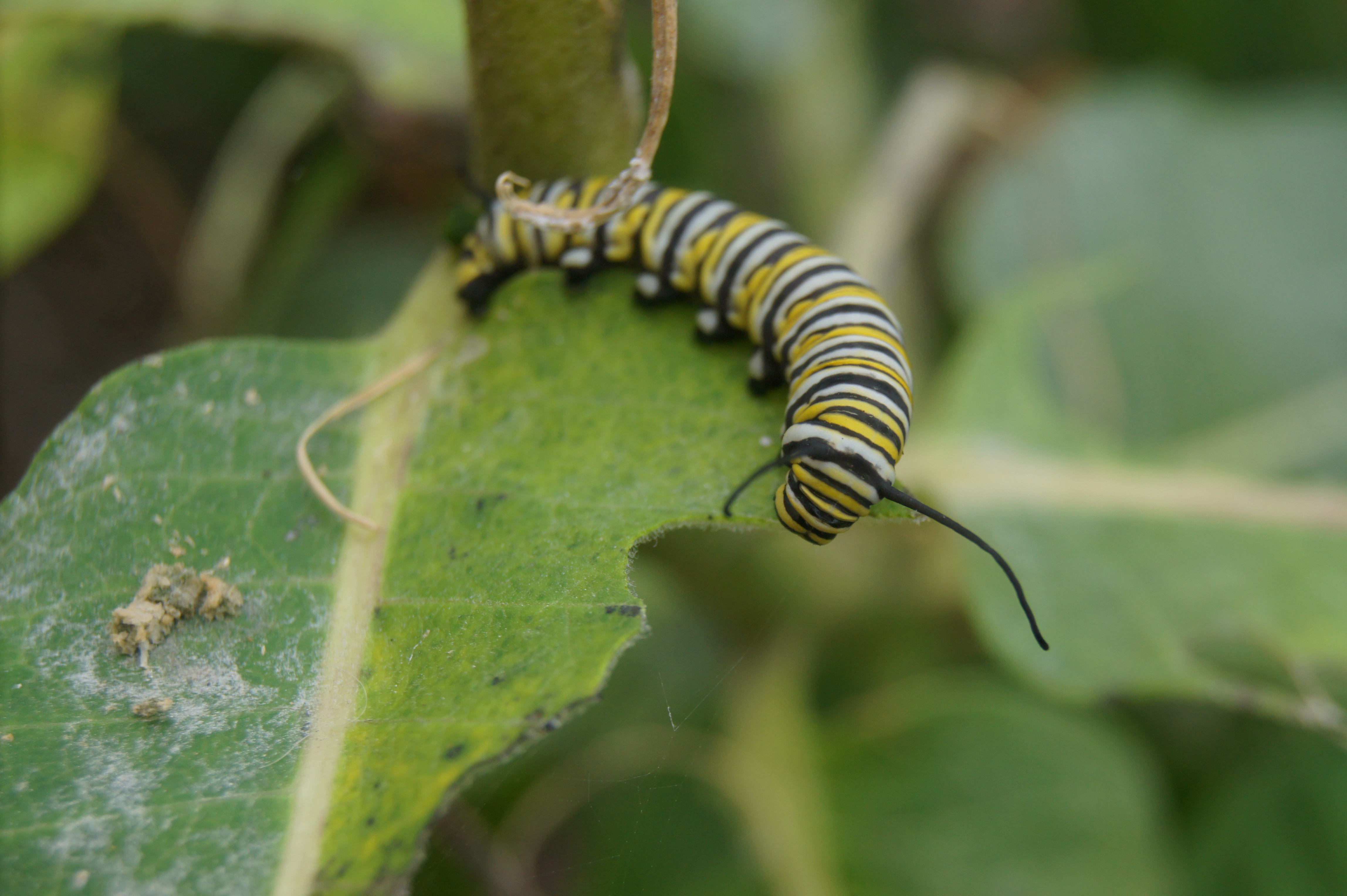
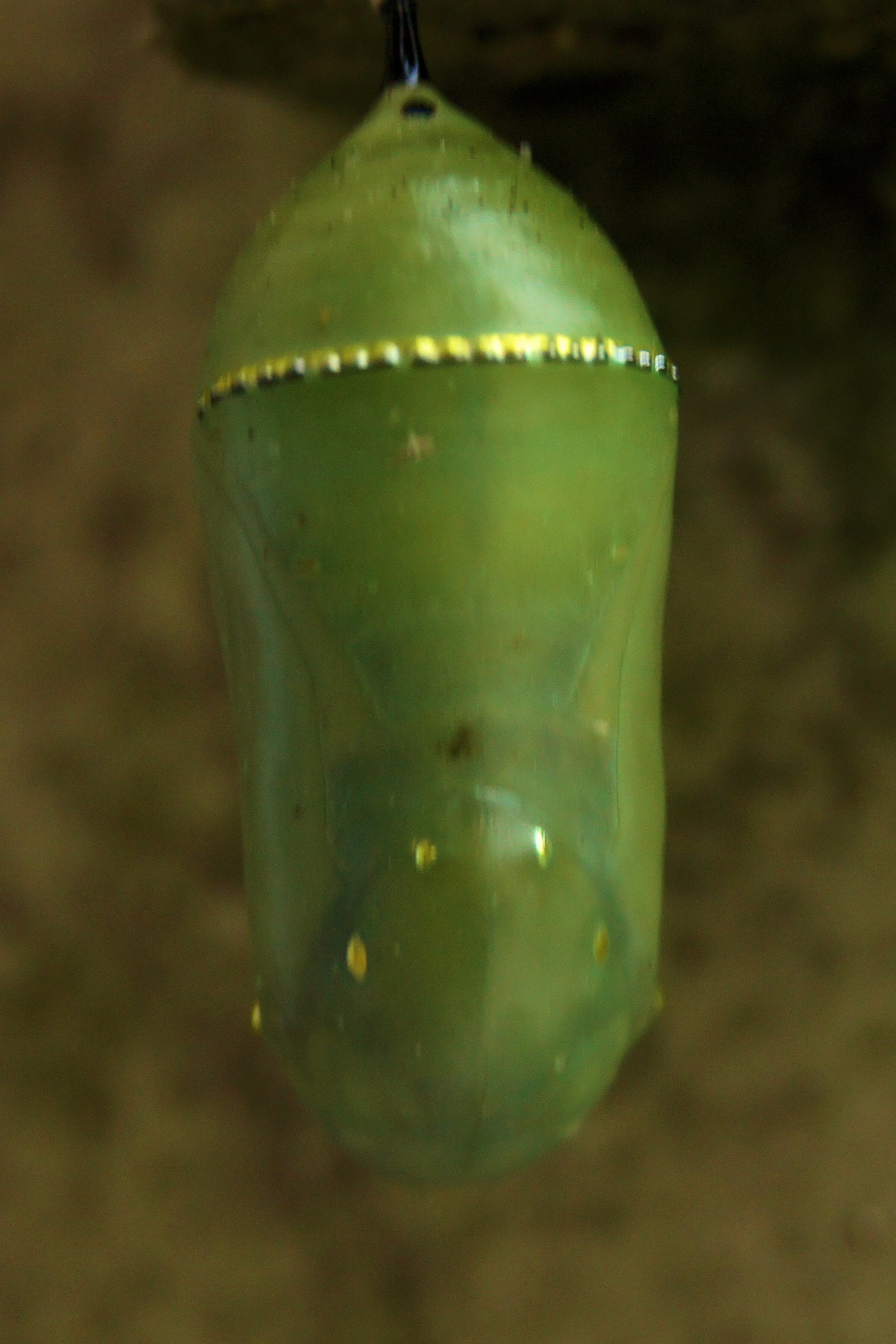
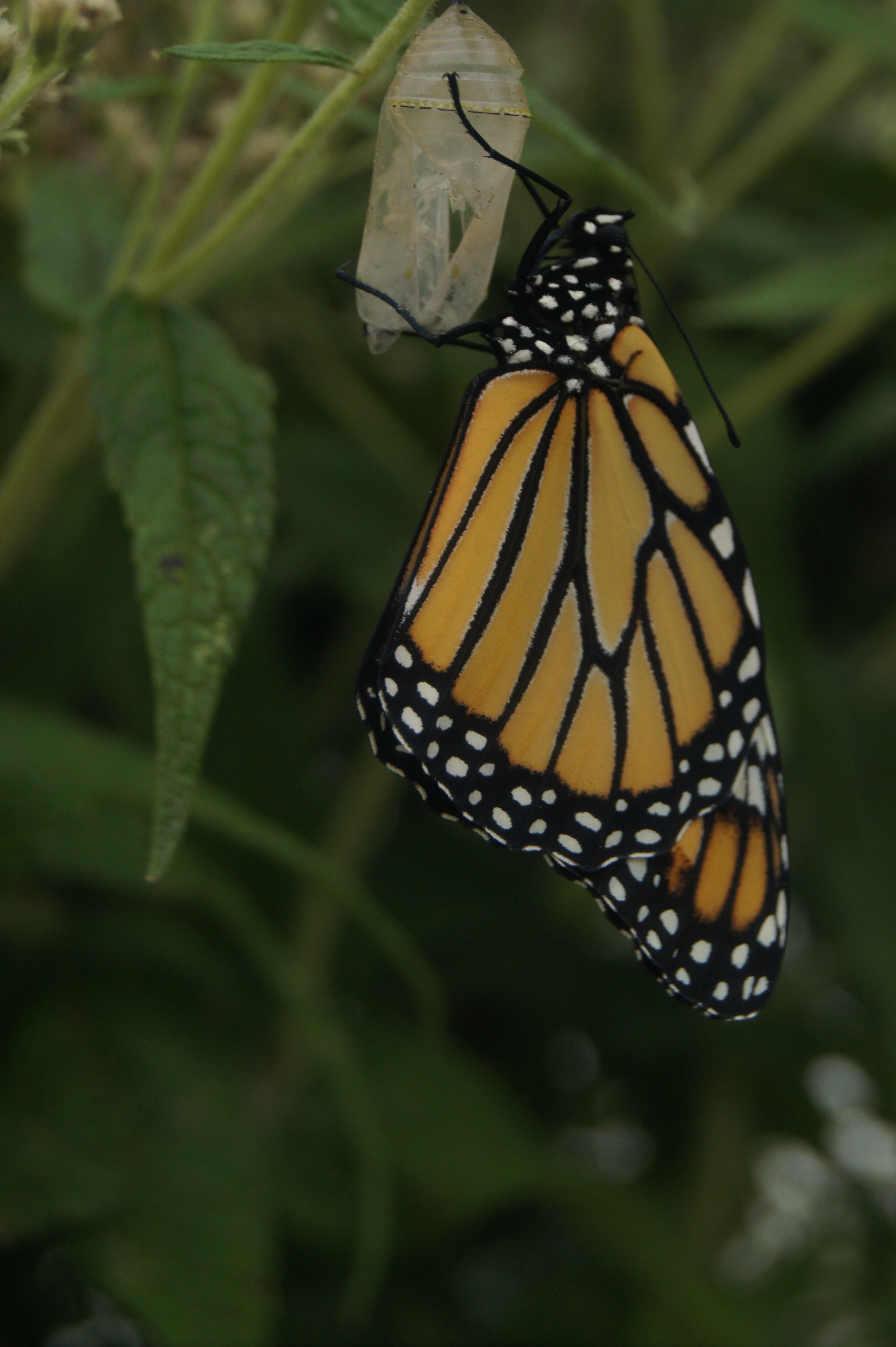
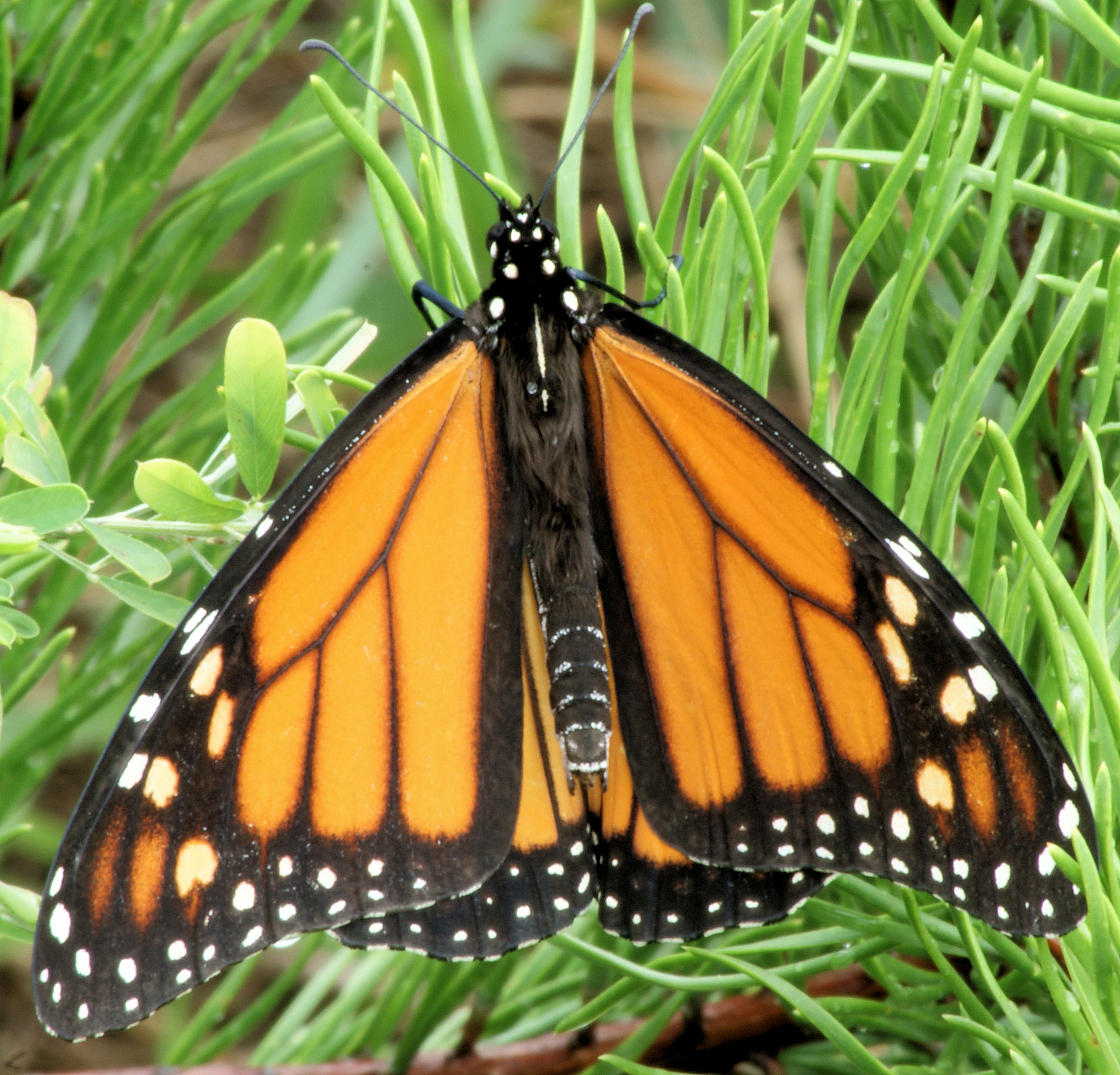
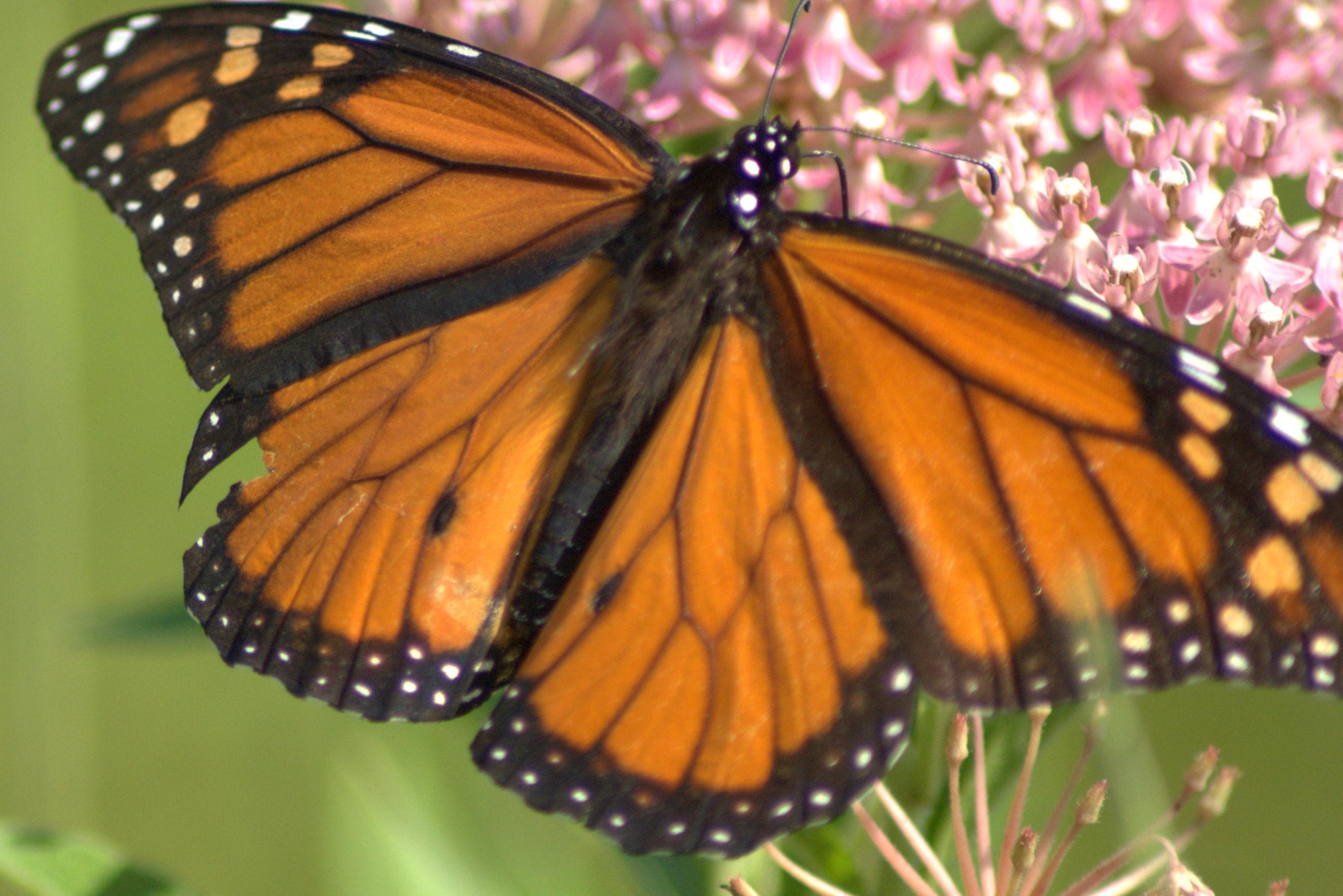
In August 2010, I took a series of pictures of photographs of the Monarch Butterfly at various life stages. Unfortunately, I did not see any eggs.
All of the photographs were taken on the Patuxent Research Refuge. I hope you enjoy looking at them.
(Scroll down to see all photos and click on photos for fuller views.)