While driving down Telegraph Road, I saw some movement in a mud puddle in front of me. I slowed down and discovered a bunch of American Toad (Bufo americanus) swimming around. Looking a little closer, I discovered that they were mating. I also spotted some egg strands.


Archives
12 March 2012 – Eastern Fence Lizards and Black Widow Spiders
Today I did not do much botanizing. Instead I just drove around to see what I could find. Along side South Road near the BGE Powerline Right-of-way I spotted a lizard, which I believe is an Eastern Fence Lizard.
In the cleared area near the Old Village Corner, I spotted a cool looking spider walking across some exposed sandy soil. It is a Northern Black Widow Spider (Latrodectus variolus), possibly a male.


1 March 2012 – First Spring Beauty of the Year

SPRING IS HERE!
Today along the Little Patuxent River Trail spotted the first Spring Beauty (Claytonia virginica L.) of the year blooming. By comparison last year, the spring beauty was spotted on 16 March. By the looks of one of the plants, it has been blooming for at least two or three days.

Other plants blooming for the first time today include:
American Elm (Ulmus americana
Ivy-leaf Speedwell (Veronica hederifolia)
Callery Pear (Pyrus calleryana)
29 February 2012 – American Hazlelnut – Corylus americana

Today, I spotted some American Hazelnut (Corylus americana Walter) along Bald Eagle Drive just north of the Contact Station. It was in full bloom with both male (staminate) flowers and female (pistillate) flowers. The staminate flowers were on 3 to 4 inch long pendulate catkins and the red pistillate flowers were on the tips of buds. I am going track these plants this year to see if they will produce nuts.


25 February 2012 – Flight 93 Memorial, Shanksville, Pennsylvania
This is a departure from my usual nature related posts, but I don’t have another place to put it.
While up in Somerset, PA today, we decided to visit the Flight 93 Memorial in nearby Shanksville. It was 23 degrees and snowy so we did not spend a lot of time outside. There is a heated memorial plaza next to the location where the plane crashed into the ground. A ranger was there to greet visitors and answer questions.
It is still hard to imagine what happened that day in New York City, Washington DC and in Shanksville.
(Please click on the photos for an even larger view)


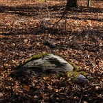
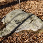
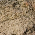
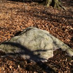
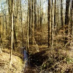
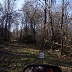
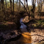
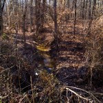
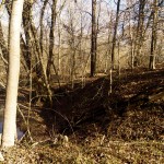
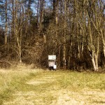
23 February 2012 – Rocky outcropping
Today, while looking at some populations of club mosses (Lycopods) I discovered a rocky outcropping in the woods near the Hopkins Cemetery. While at first glance this may not seem like a big deal, but it is. I have been all over the North Tract and this is the first time I have seen a rocky outcropping. There may be other rocky outcroppings on the North Tract, but if there are, they are not common.
I am not knowledgeable about geology. If you can help me identify the type of rock this is, please let me know.
Click on the thumbnails for higher resolution.

18 Februrary 2012 – Red Maple in Bloom!


Last year, I did not spot any red maple’s blooming until mid-March. By the looks of these trees, I guess they may have been in bloom for at least one week.


18 February 2012 – A Giant Sycamore – Platanus occidentalis

Today, Ranger Jeff Bolden and I visited our Giant Sycamore on the North Tract. Although, the tree is not a state champion, it is still a large tree. According to someone who recently measured it, the diameter at 4.5 feet off the ground is 73 inches, and it is 119 feet tall. In comparison, this tree is almost as tall as the Maryland state champion, which is 121 feet tall. However, the state champion is 103 inches in diameter. The current species champion is over 130 inches in diameter. Even so, our tree is still a giant.
Our big tree is located about 500 feet east of the Old Forge Bridge in the bottomland woods on the north shore of the Little Patuxent River. This area is subject to periodic flooding.


31 January 2012 – Eastern Arborvitae – Thuja occidentalis

Today, Joe DiGiovanni and I went out to the Duvall Cemetery just to look around. While there I realized that I had not collected a specimen from the Thuja occidentalis or Eastern Arborvitae/Northern Whitecedar tree on the Duvall Cemetery. It is the only known example of this species on the North Tract; although I would not be surprised if it were to occur elsewhere. Obviously, it was planted as an ornamental in the cemetery because it is not not native to this part of Maryland.


20 January 2012 – Processing Last Season’s Collected Specimens

Now that is the off-season for collecting plants, I am spending my time identifying and processing the specimens collected last year. According to my logbook, I collected 928 specimens and after accounting for duplicate specimens, there are about 700 to 750 different species.
We will now send a specimen sheet of each specimen to the National Herbarium at the Smithsonian Institute and keep one specimen sheet for the refuge’s herbarium for mounting and preservation. (Each specimen has two or three specimen sheets.)
I will also take an inventory of the plant species collected and compare the list against what was historically collected on the South and Central Tracts of the Refuge. That way I can determine what plants to look for next season.

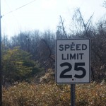
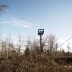
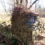
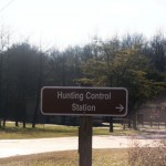
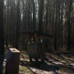
12 January 2012 – Main Gate to Contact Station
Today, let’s take a look at the sites along Bald Eagle Drive between the Main Gate and the Visitor Contact Station.
At this point it is important to note that some of the main roads are scheduled to be re-paved this spring. Bald Eagle Drive along its full length from Fort Meade Road to the Contact Station is part of this project. It will be nice when they are done because the road is full of potholes.
After you pass through the main gate you are immediately greeted with a sign instructing visitors to proceed to the Visitor Contact Station, one mile ahead.

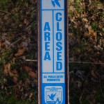
There is also a sign warning visitors to be aware of unexploded ordnance (UXO). Before 1992, the North Tract was part of Fort Meade and there is the possibility of finding UXO. Rest assured that most of the public areas have been swept and if you stay in these areas the chance of finding a UXO is very very low.

There is a 25 MPH speed limit on the refuge. There are sections of road where you can’t go more than 25 MPH even if you want to due to poor road conditions.

Click on thumbnails for larger view.


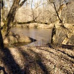
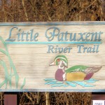
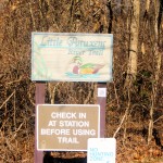
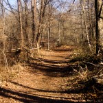
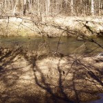
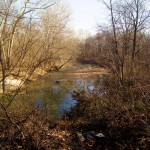
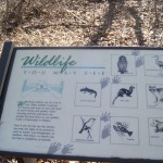
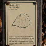
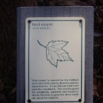
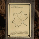
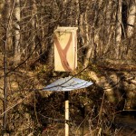
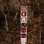
10 January 2012 | Little Patuxent River Trail

The Little Patuxent River Trail is a showcase trail on the North Tract. It is located along the Little Patuxent River. The trailhead is about 300 feet north of the Visitor Contact Station. Let’s take a tour of the trail.

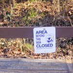
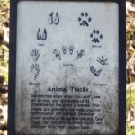
There are many signs on the trail starting with the one at the trailhead which names the trail itself.


UPDATE – SPECIAL USE PERMIT

Let the fun continue for at least one more year.
Bill
30 December 2011 – Whirlwind tour with my daughter Jen
Today I had the pleasure of taking my daughter Jen on a whirlwind tour of Refuge. She is from Washington State and was in Maryland with her husband and two of our grandchildren to visit my wife and me for the holidays. We drove the entire Wildlife Loop, including the part by the firing ranges where the general public normally does not see. Some of the highlights included driving by Tipton Airfield, seeing Lake Allen, looking at the Prickly Pear (Opuntia humifusa) near the Lake, and driving through some of the western part of the North Tract. It was fun showing her the refuge and I think it was fun for her connecting the locations she had heard about with actually seeing them. It was a good chance to spend some quality father-daughter time.

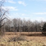
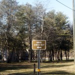
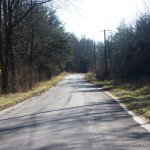
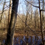
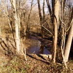
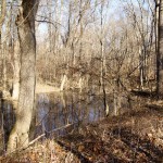
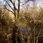
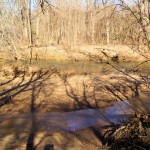
27 December 2011 – Going out to the end of Millrace Road
Today, 27 December 2011, I went out to the end of Millrace Road to Emmy’s Pond. Took some pictures along the way.


Emmy’s Pond is located at the end of Millrace Pond and is named after Emmy Holdridge, a volunteer on the refuge who brought it to the attention of people on the refuge.
Millrace Road is follows a major part of the southern boundary of the North Tract. To access it, you must turn right off of Duvall Bridge Road just before you get to Duvall Bridge. The road is roughly two miles long. For the first part of the road, you can see the Millrace itself. It is a channel which was dug many years ago, and still has running water fed mostly from Thomas Branch. Just past Millrace, you can see Millrace Swamp on your right. (NOTE: Millrace Swamp is the body of water pictured in this blog’s banner above.)
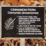
Continuing past Millrace Swamp the road passes over Old Thomas Branch and Cinnamon Fern Branch before arriving at Emmy’s Pond.
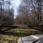
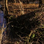
The road is impassable to vehicles at Emmy’s Pond due to fallen trees and roadbed erosion. It is possible to hike the road to the end at Patuxent River. Along much of Millrace at the far end there is a bluff to the north that will be worth exploring this next season.
I found some Indian Pipe (Monotropa uniflora) at one station on the bluff last year.